

Army put on standby with Storm Doris set to hit ALL of UK at 5am TODAY

THE Army has been placed on standby over fears Storm Doris will cause flying debris and damage to buildings.
The Armed Forces will be on hand to support emergency services in areas hit hardest by the storm, which is expected to bring winds up to 80mph with it when it hits the UK this morning.
A spokesman for the Ministry of Defence said it would be on hand to tackle any disruption caused by the severe weather.
The MoD spokesman said: “Our Armed Forces are committed and professional and are ready should they be needed to support local authorities in responding to adverse weather in our communities.”
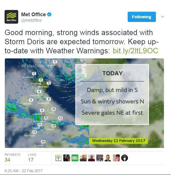
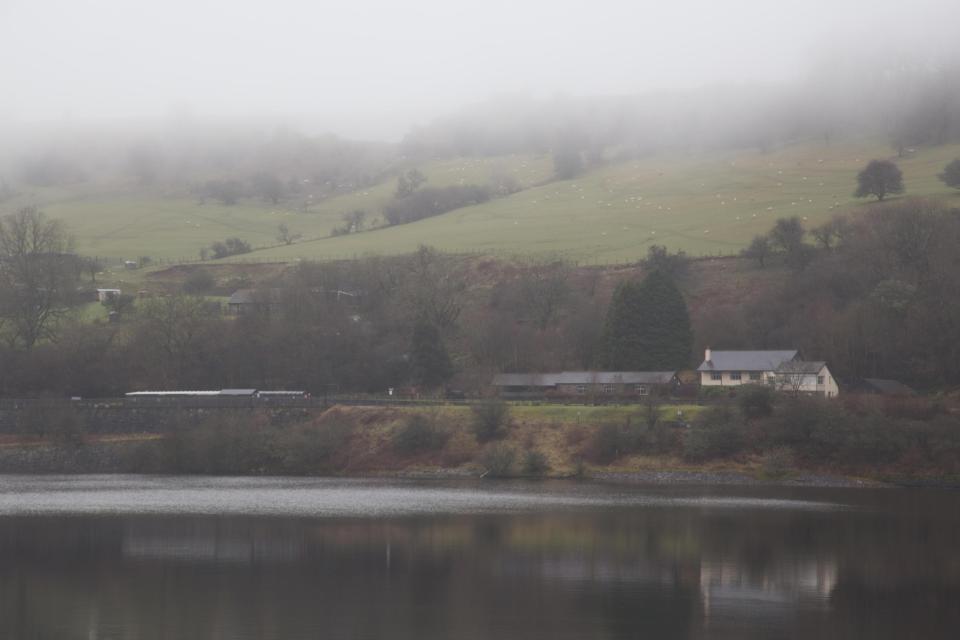
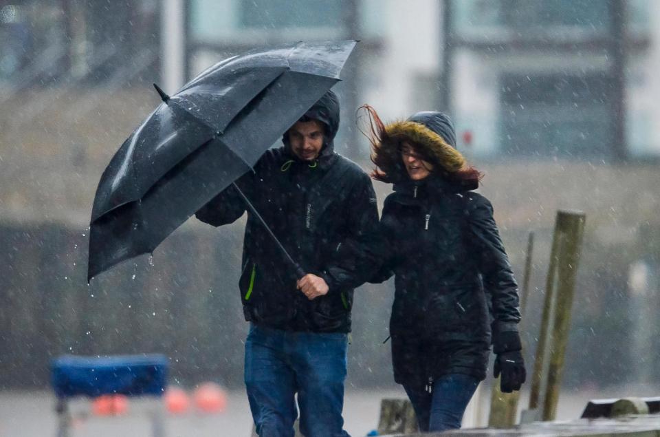
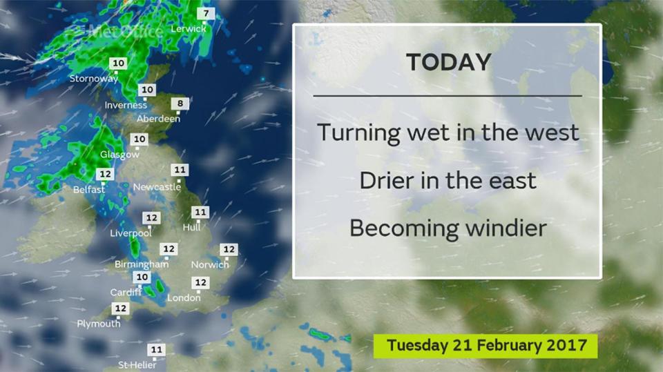
Heavy rain will batter the UK today as high winds and pelting rain sweeps across the land, while snow is expected in Scotland.
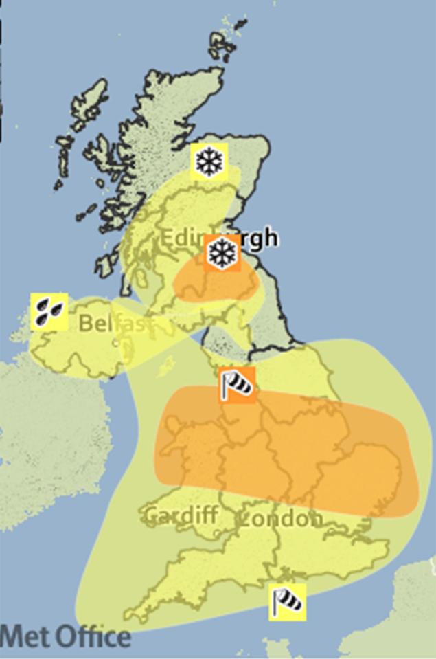
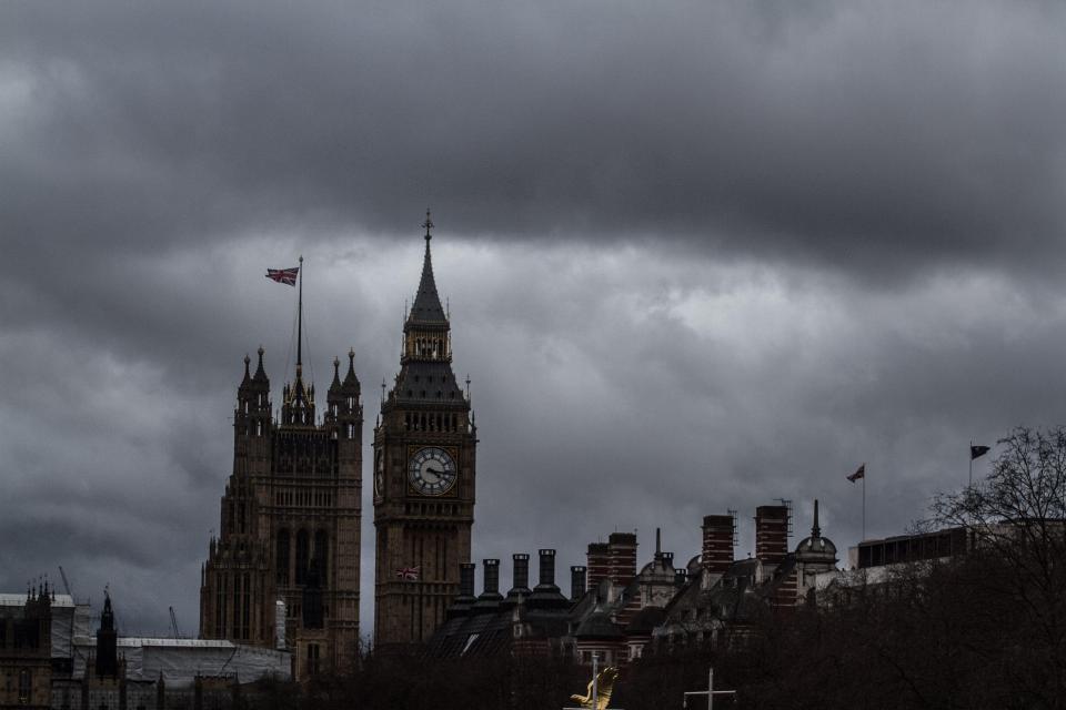
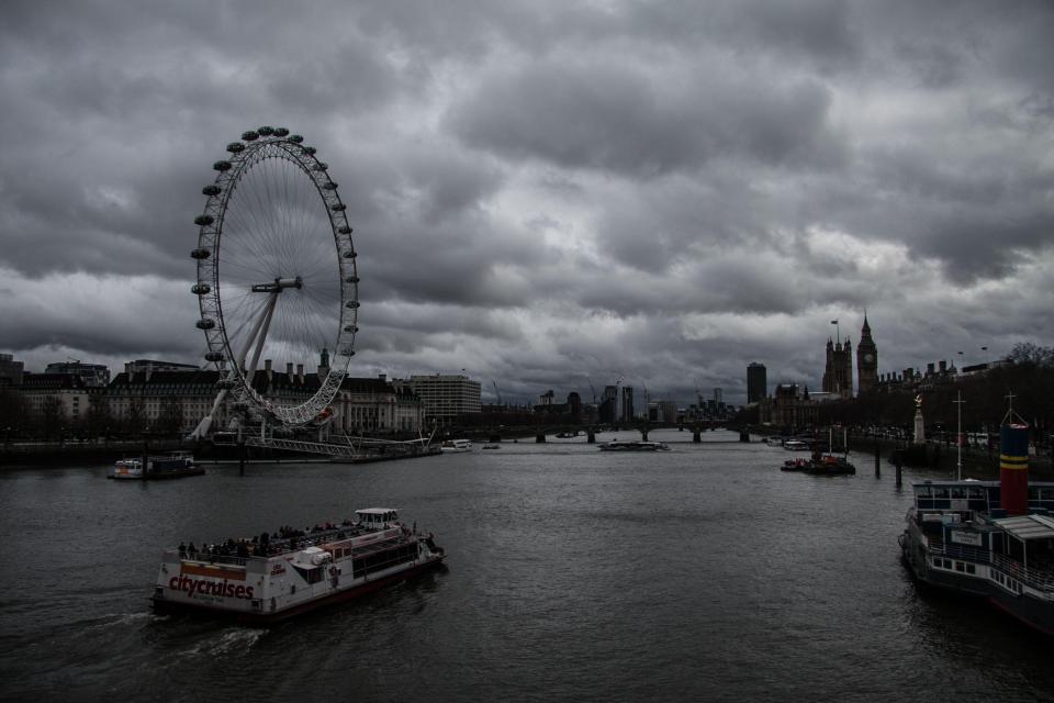
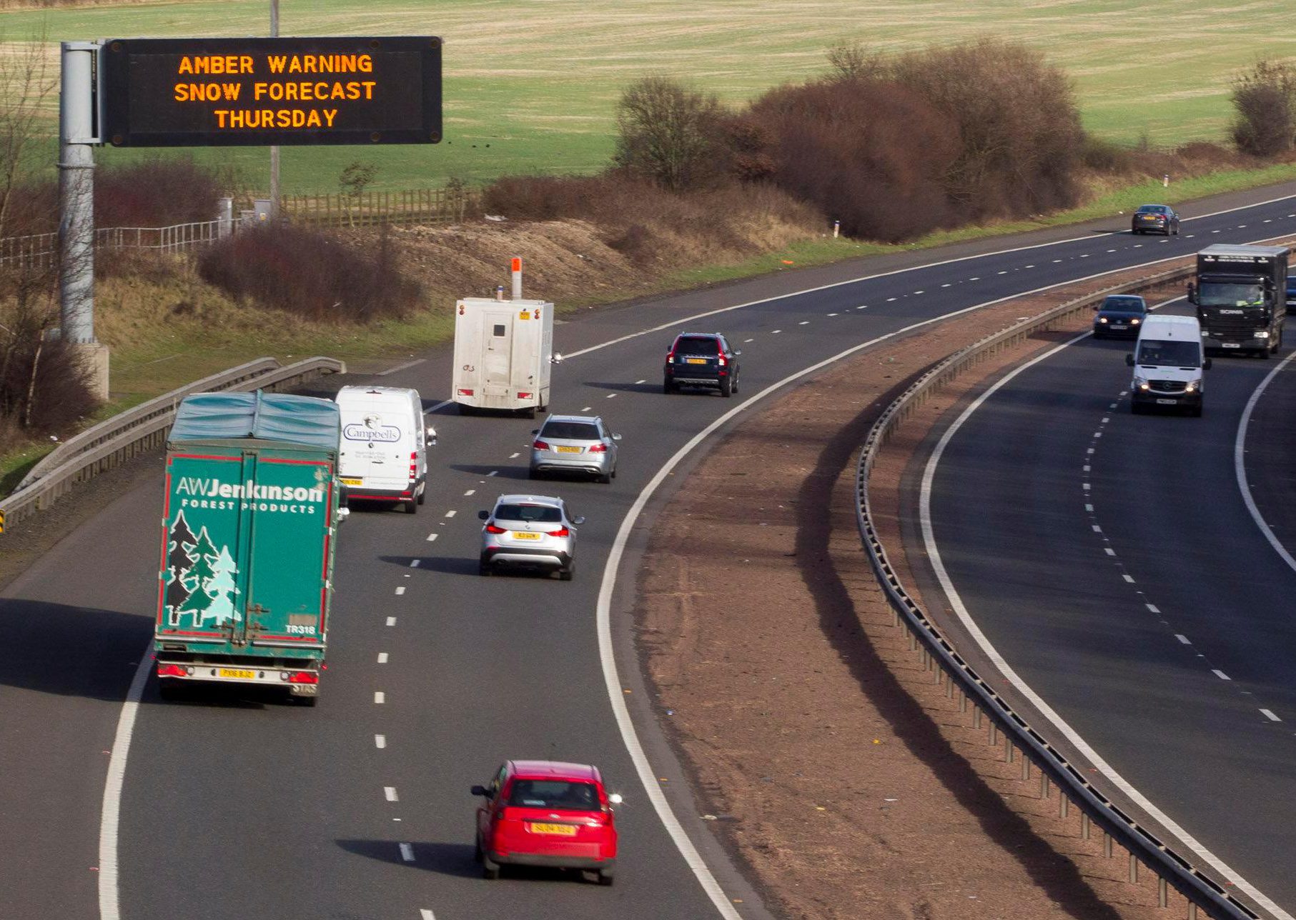
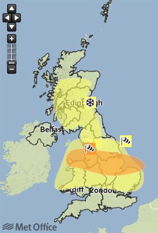
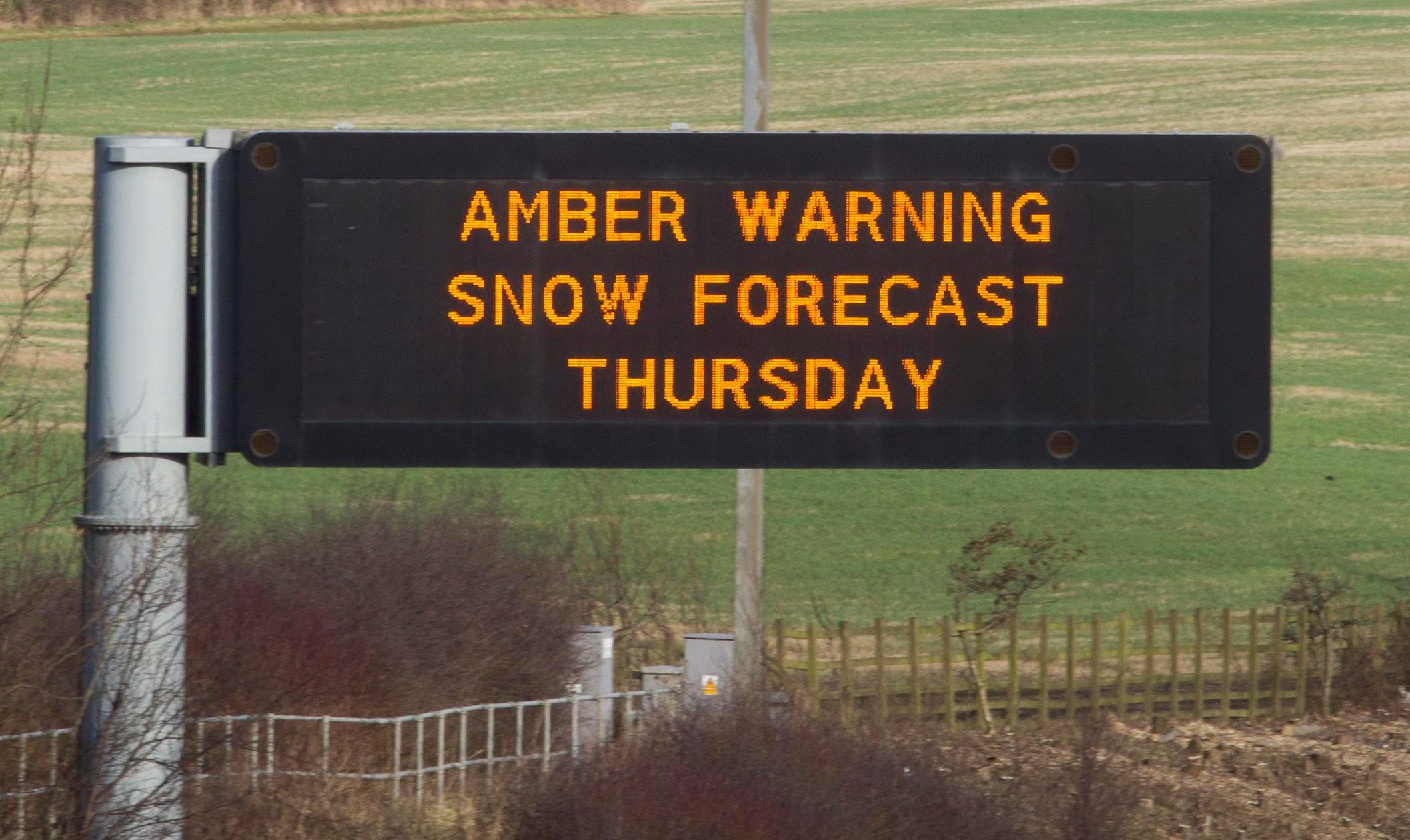
An amber "be prepared" warning has been issued by the Met Office as the country braces itself for Storm Doris.
A yellow warning of "be aware" is also in place in the Midlands, northern England, Wales and Scotland as Storm Doris makes her way towards the UK.
Winds as fast as 60mph are also expected to batter southern England, and the Met Office may be forced to extend the weather warning to the region.
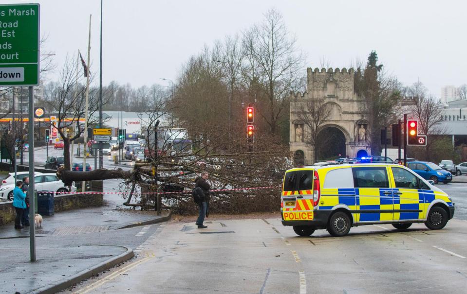
A tree has fallen onto a car with a schoolboy inside as Storm Doris sweeps across the UK.
The 13-year-old boy was taken to hospital as a precaution, but is believed to have escaped the incident with minor injuries.
The horrifying incident took place in Bristol at around 4.15pm yesterday, according to the
Speaking at the scene, a PSCO said a raised concrete wall stopped the tree from crushing the car completely.
Firefighters attended the scene to remove the tree from the vehicle.


One witness told the Bristol Post a group of teenagers were walking along the road when the tree was uprooted by furious winds caused by Storm Doris.
An off-duty paramedic who happened to be passing by helped the young boys.
It is expected to cause delays and cancellations to flights from Heathrow.
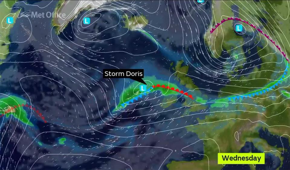
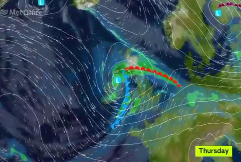
Met Office forecaster Emma Sharples said: "We have got a fairly active area of low pressure coming in from the Atlantic.


"It is strengthening as it moves eastwards to the UK."
Planes could be seen battling strong cross-winds as they tried to land at Leeds Bradford Airport on Wednesday morning.
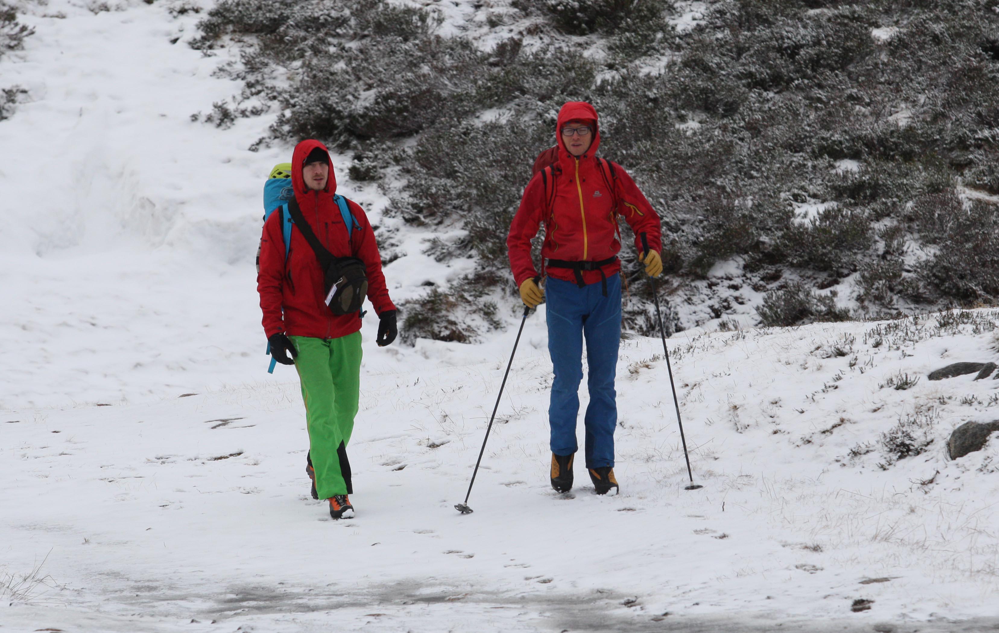
Already in north east Scotland has been hit by a flurry of snow as the first of signs of Storm Doris moved into the UK.
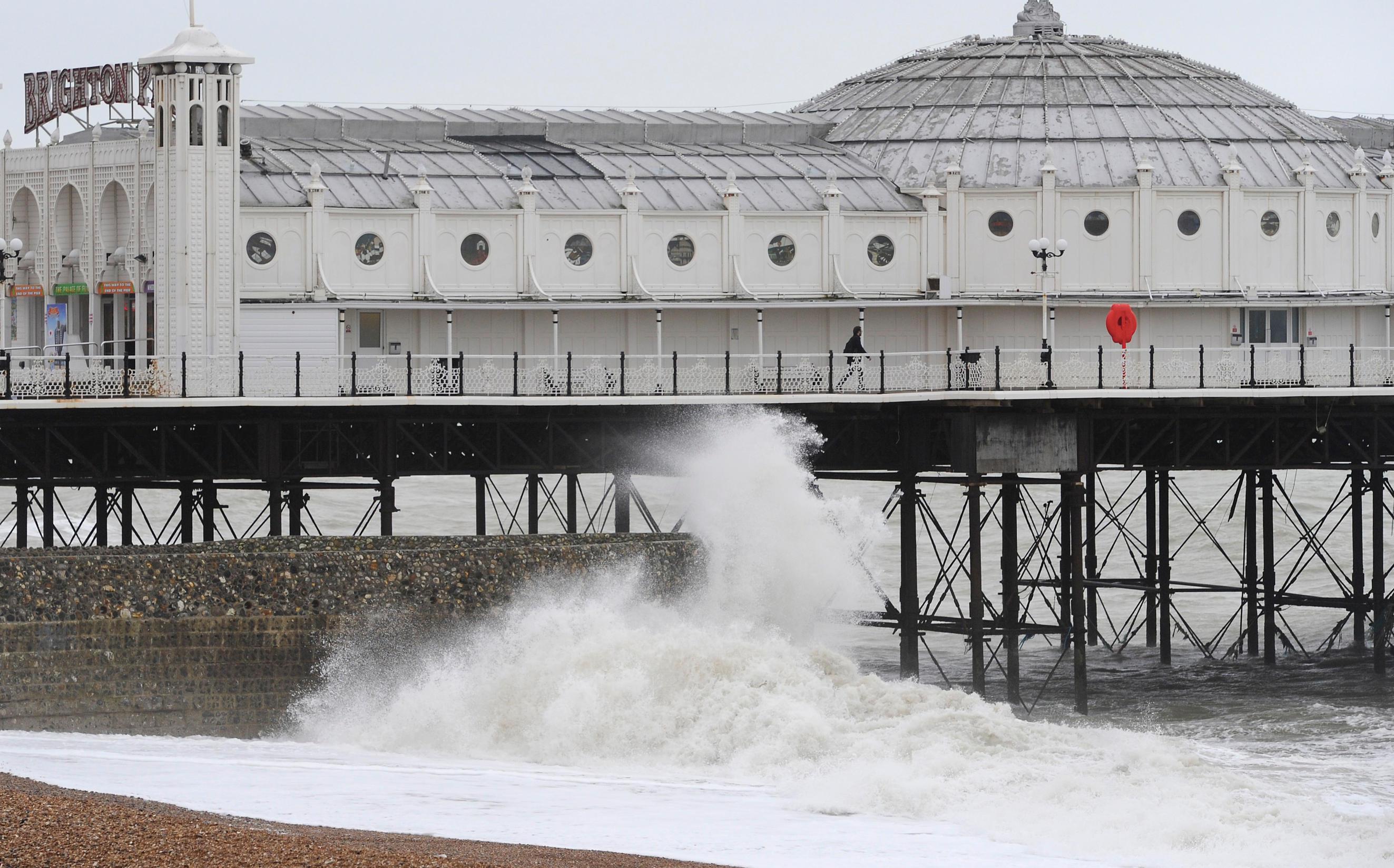
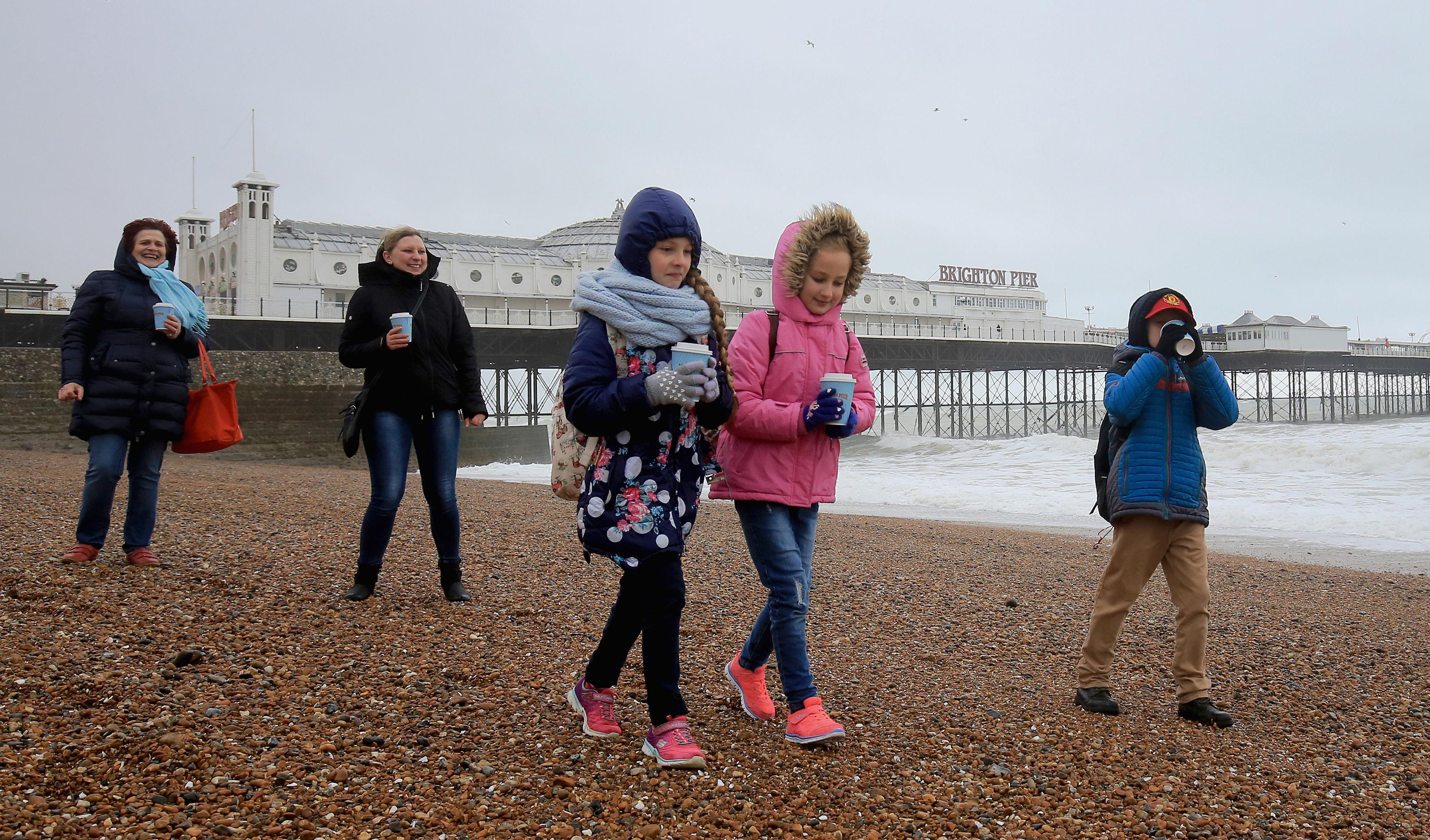
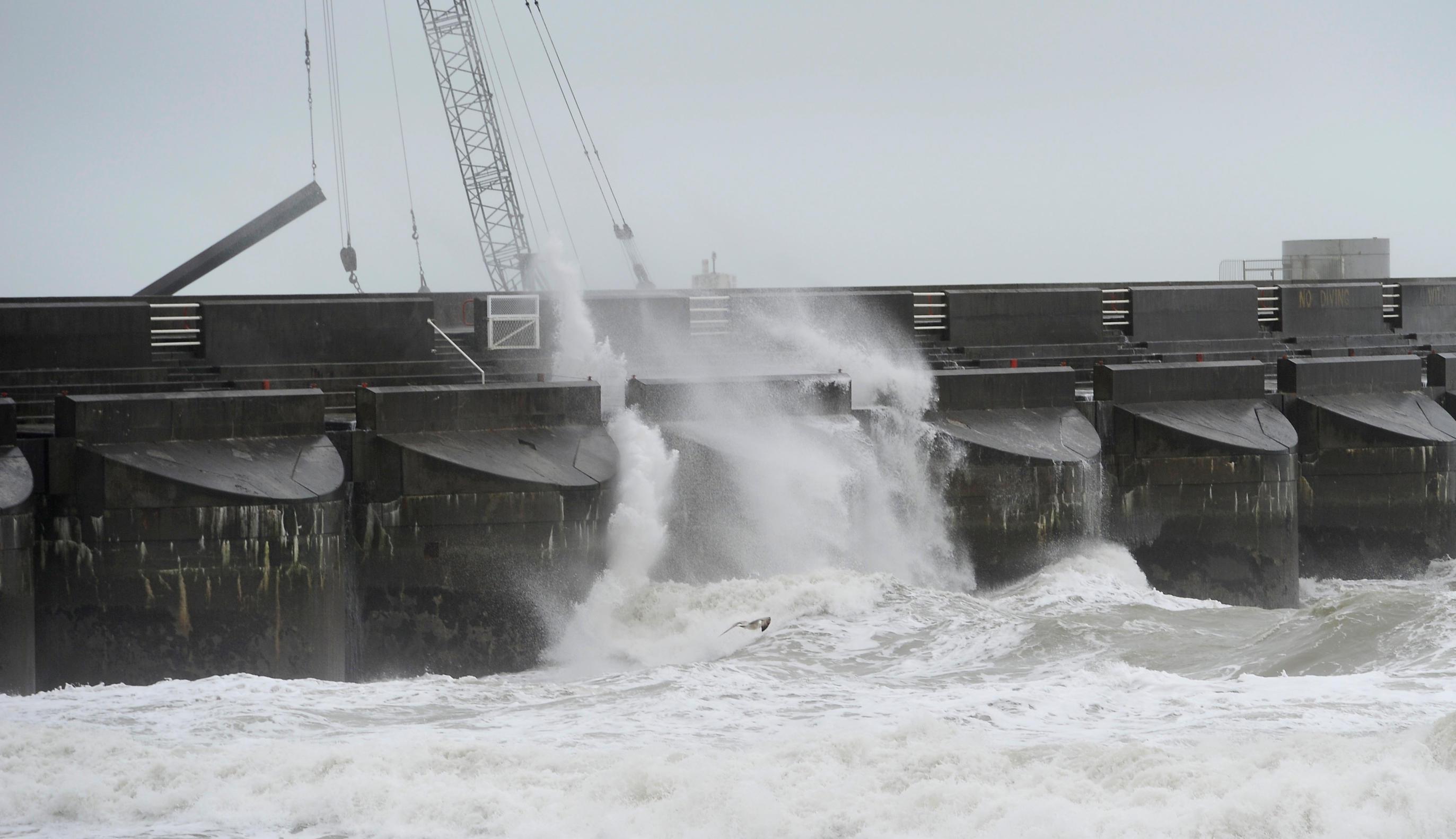
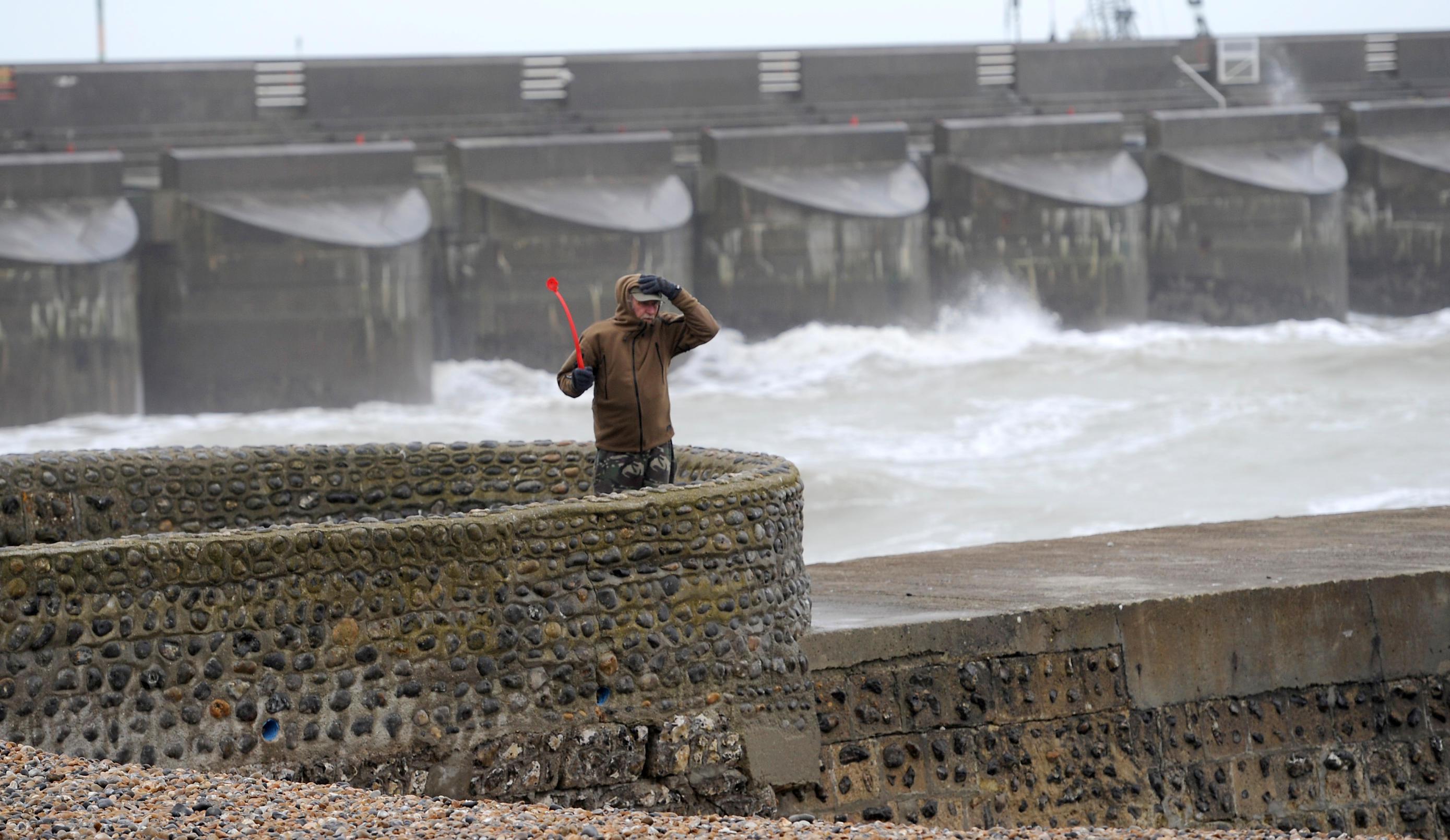
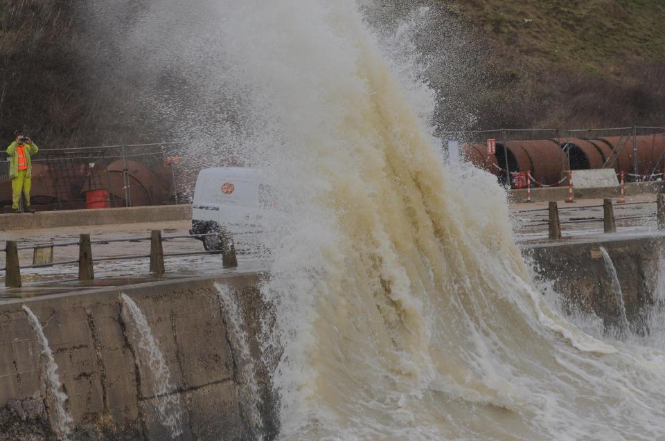
While at the opposite end of the country in Brighton, waves could be seen crashing at the side of the pier because of strong winds in the south.
The Met Office's amber weather warning alerts people that "whilst the strongest winds look to be only short-lived, damage to structures, interruptions to power supplies and widespread disruption to travel networks are likely, with a danger of injury from flying debris".
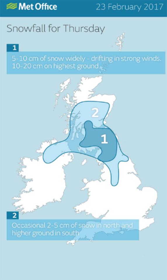
A weather warning for snow is also in place for Scotland, which could see "treacherous" and blizzard-like conditions today.
Storm Doris is expected to move on quickly, with the worst of the weather gone by this evening.
RELATED STORIES


While further Atlantic gusts will bring more rain and wind through the weekend and into next week, they are not expected to reach the heights of Doris.
Storms with the potential to cause substantial impact are named by the Met Office and Met Eireann, moving through the alphabet.
The first was named Abigail in November 2015, after members of the public suggested monikers for the "name our storms" project.

But the weather warnings will be in place from 6am today until 6pm.
The forecasters are now in their second run of the alphabet - after Doris, Britons can expect to hear of Storms Ewan, Fleur and Gabriel.
Storm Doris's appearance contrasts with Monday's temperatures, where visitors to Kew Gardens, west London, enjoyed the warmest day of the winter so far, at 18.3C (64.9F).
Parts of London and the south of England experienced temperatures warmer than Ibiza, southern Spain and Menorca.
There were concerns Doris would hit earlier this month but the weather never reached the threshold needed to be classified as a storm by the Met Office.
Forecasters re-evaluated this position earlier on Wednesday and announced Storm Doris had formed and was heading for the UK on Thursday, bringing with it snow, rain and 80mph winds.
This time last year, the UK had already been hit by nine named storms but Doris is just the fourth - following Angus, Barbara and Conor.
The Met Office only names storms when forecasters believe them to have the potential cause amber 'be prepared' or red 'take action' warnings and do this in order to make people more aware of sever weather.
The stormy conditions follow a warm air blast from tropical America which pushed thermometers into double figures.
Now the Met Office has issued for snow and wind from the early hours of this morning.
The warnings stated on Wednesday: "Snow is expected over high ground of northern England and Scotland on Thursday and may fall to low levels for a time in Scotland.
"In addition, strong winds are expected to develop with gusts of 50 to 60 mph. This will result in drifting of the snow and blizzard conditions over high ground. Associated heavy rain at lower levels will be an additional hazard.
"The combination of snow, strong winds and heavy rain is likely to lead to disruption to transport networks and perhaps power supplies."
RELATED STORIES


The Met Office said that stronger winds may develop across parts of "northern England, northern Wales and the north Midlands".
They added: "Some very strong winds are expected throughout Thursday in association with storm 'Doris', with a short period where gusts of 70 to 80 mph are possible.
"Whilst the strongest winds look to be only short-lived, damage to structures, interruptions to power supplies and widespread disruption to travel networks are likely, with a danger of injury from flying debris."
The warnings mark a dramatic change from the weekend when the mercury rose to 15C (59F), around 10C higher than average for mid-February.
Thermometers hit 18.3C (65F) in the south yesterday while the north enjoyed highs of 15C plus making it the warmest day of winter.
The Met Office said wind and rain will set in tonight before a more powerful storm system hits on Thursday.
Spokeswoman Nicola Maxey said: “Although Tuesday will be mild it will not be as warm as Monday although temperatures will still be above average.
“Rain will start to move in later in the day and some of this could be heavy, it will also be quite gusty as winds pick up overnight into Wednesday.
“Gales could bring gusts speeds of 60knots [69mph] into Thursday and as it turns colder there is a risk of snow which could be heavy over 400 metres
“Although a name has not been issued for Thursday’s system there is the potential for this to happen, the next storm name would be Doris.”
The turbulent weather is being blamed on a powerful jet stream stretching over the Atlantic dragging storms into the UK.


WeatherOnline forecaster Garry Nicholson said: “A changeable weather pattern will dominate during the week ahead as several frontal systems move in from the Atlantic.
“Rain will be frequent, and there will be gales at times.
“Temperatures will drop compared to the very mild values seen earlier this week, and there may be snow on northern hills.
James Madden, forecaster for Exacta Weather, claimed there is the risk of more widespread snow into next month.
He said: “It is likely that there will be some rather chilly evenings under clearer skies this week with some dense pockets of fog developing in places.
“This will pave the way for a colder weather pattern, we could see further snow during the final third of the month and into the start of the meteorological spring.”
Temperatures will remain above average today hitting 13C (55.4F) in the south and between 6C (42.8F) to 8C (46.4F) in the north.
By the end of the week London and the south can expect highs of 11C (51.8F) or 12C (53.6F) while elsewhere will struggle to get much above 5C (41F).
At the beginning of February, the UK suffered half a month’s rainfall in one day and faced 70mph winds.
We pay for your stories! Do you have a story for The Sun Online news team? Email us at [email protected] or call 0207 782 4368
We pay for your stories! Do you have a story for The Sun Online news team? Email us at [email protected] or call 0207 782 4368